Satellite imagery shows 70km ‘trench’ of Russians in Zaporizhzhia region
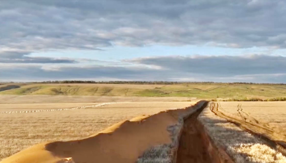
The Center for Journalistic Investigations spotted the invaders’ fortified area on Sentinel-2 satellite imagery, reports Ukrinform.
"The extreme points of the Russian fortified area in the west, spotted thanks to the Sentinel-2 satellite imagery, are located on the outskirts of Semenivka village. It is approximately 9 km from the center of Melitopol which the occupation authorities of the Russian Federation designated as its capital in the region. In the east, the extreme point of the erected fortifications is in the field outside the village of Marynivka in Prymorsky district," the report reads.
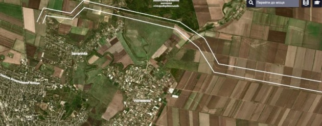


Analysis of satellite data indicates that the construction of this defense line began in early September 2022.
The occupiers started digging a trench simultaneously from two directions, and as of October 18, the mega-trench was ready. Its continuous length is 70 km. This is almost a third of the length of Zaporizhzhia region from east to west (205 km) and is approximately equal to the distance, for example, from Kherson to Mykolaiv or from Vienna to Bratislava, the Center for Journalistic Investigations notes.
As reported, the Russian troops mine the territory near Enerhodar, Zaporizhzhia region.
Photos: Sentinel-2 satellite imagery

