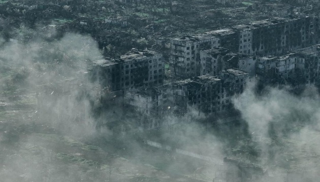
British intelligence publishes satellite images showing destruction of Bakhmut
"During the Russian offensive to capture Bakhmut, intense fighting and indiscriminate targeting of buildings results in extensive damage through the city. Schools, train stations and residential buildings, as well as other civilian infrastructure, have been damaged, and in some cases destroyed," the British intelligence posted on social media platform X, referring to intelligence data.
Latest Defence Intelligence update on the situation in Ukraine - 11 August 2024.
— Ministry of Defence 🇬🇧 (@DefenceHQ) August 11, 2024
Destruction in Bakhmut, Ukraine, since the Russian offensive of the city.#StandWithUkraine 🇺🇦
As reported by Ukrinform, the Russian Ministry of Defense announced the start of a land operation in Bakhmut on August 1, 2022. As a result of active hostilities, 80% of Bakhmut was destroyed.
According to the General Staff of Ukraine, the Russian army’s total combat losses in from February 24, 2022 to August 11, 2024 amounted to about 590,920 troops, including 1,220 invaders killed or wounded on August 10.
Photo: Liberov


