Ukraine does exist on old map presented to Putin – mass media
The relevant statement was made by Poligon Media, an Ukrinform correspondent reports.
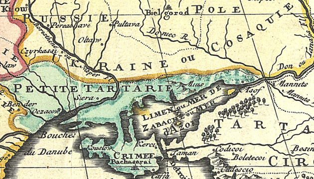
“Ukraine does exist on the map presented to Putin by Valeriy Zorkin. It is called Ukraine Pays des Cosaques, which can be translated from French as ‘Ukraine, the land of the Cossacks’. At that time, it was part of the Polish-Lithuanian Commonwealth,” the report states.
The map was made by the French cartographer, Guillaume Sanson, in the 17th century.
Moreover, Verstka publication noted that Crimea was not part of Russia on that map. It shows the peninsula circled as a separate state. In the 17th century, the Crimean Khanate was located there, which in alliance with the Ottoman Empire fought against Russia.
A reminder that, on May 23, 2023, Putin met with Russia’s chairman of the Constitutional Court, Valeriy Zorkin, who had brought a 17th century map, where Ukraine allegedly was not marked as a state.

